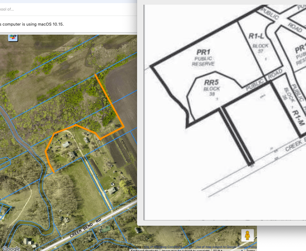
Environmental group Save Our Seine’s interest in SE Winnipeg land development issues rises exponentially the closer that the development site is to the Seine River. Precinct K’s historic Smith Farm property is situated at ground zero for Save our Seine. This is definitely SOS country.
Home to the English immigrant Smith family for several decades, the fields that once made up Smith Farm have been sold to Qualico Development one inherited lot at a time for the last decade. Only one small 5-acre Smith Farm landholding remains in family hands. This year is the first time in a century that their fertile farm fields have laid fallow.
Smith Farm’s private wooden bridge over the Seine River was swept away in a spring flood in the early 1960s. Since that day the family has obtained access to their various farm houses via Crescent Road to the south (renamed in the 1970s as Creek Bend Road.)
Generations of Smith children have made forts and tree houses in the lengthy Smith Farm coulee at the properties north. Beaver often swim up the heavily treed coulee to harvest wood for their dams. The coulee is also home to deer, foxes, pileated woodpeckers and a growing coyote population.
Land in South Royalwood is still subdivided into its original seigneurial lots. Private land owners possess the lands extending to the centre of the river at its normal summer level. During further subdivision the City of Winnipeg will purchase river-bottom lands for the purpose of flood control (and for the added benefit of habitat protection.) Diagrams provided by the City for Qualico of the local Seine riverbank illustrate a hierarchy of coloured lines that merit some study.
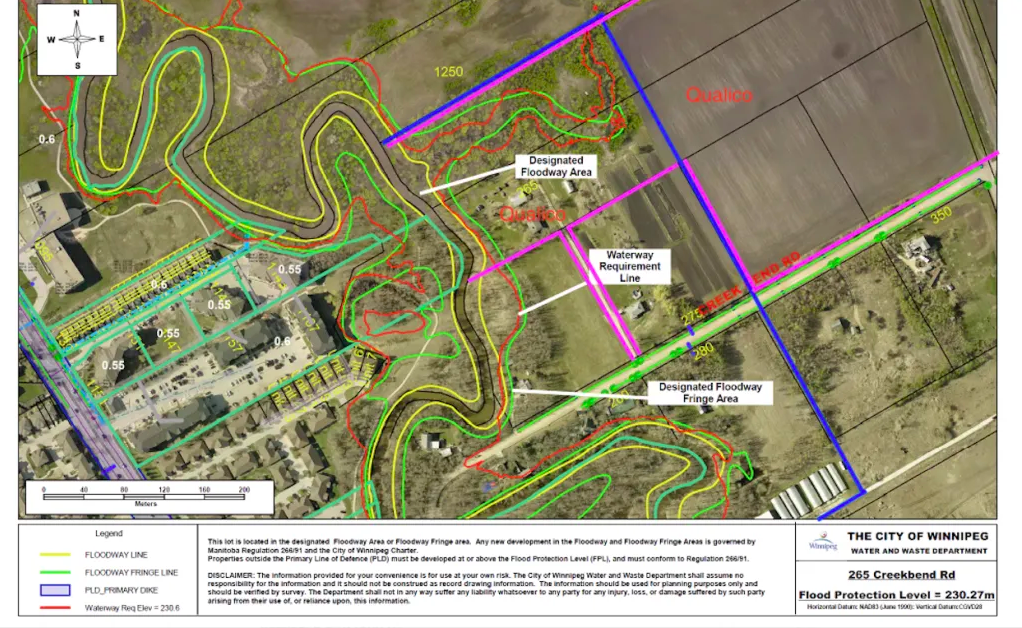
The area marked Designated Floodway Area is essentially the Seine River Valley, including the river, any low-lying valleys and oxbows and the riverbank itself. It is marked by the Floodway Line (Yellow).
The map also shows the Waterway Requirement Line (Red)
| – Lands below an elevation of 230.5 m | (756.23 ft) |
These lands are invariably purchased by the City of Winnipeg at a fixed $15k per acre. Originally reflective of actual raw land costs in the late 1990s, the City now maintains that this rate is now fixed and nominal, perhaps akin to a century-old $5 Treaty obligation payment.
The Designated Floodway Fringe Area (Green) “The Floodway Fringe: This is the area outside the floodway line but still within the broader floodplain. Construction is permitted here, but developments must meet strict Floodway Fringe Area Regulations. This includes raising the ground floor elevation to meet the mandated Flood Protection Level (FPL) and using specific floodproofing techniques.” (Google AI)
Maps provided by land use planners sometimes include the Seine River Greenway Overlay (from the 2014 Precinct K document).

The supplied map is indeed descriptive, but it is not prescriptive. The vast majority of existing homes in the Creek Bend Estate Residential area are situated in groves of river oak and other trees located within the overlay area.
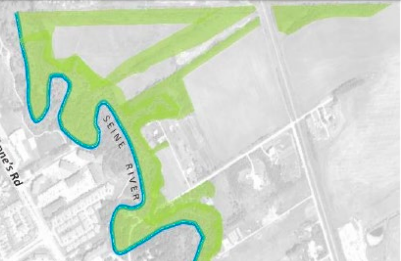
The City has never expressed any requirement to force land sales from developers within the overlay area lying beyond the Waterway Requirement Line. It is, however, preferred by the City that the developers 10% (nominal 8%) land dedication be comprised of lands located adjacent and just outside the Waterway Requirement Line. Developers are also obliged to install and pay for an Active Transportation asphalt or gravel trail in this public reserve area. The City prefers that the path be built outside the Waterway Requirement Line as it reduces yearly maintenance costs from flooding and riverbank land slippages.
Examination of the rough outlines of the lots planned for the new homes to be built on the Smith Farm homestead show the new back yards extending closer towards the river than originally proposed. Fitting an AT trail ROW onto the available top of bank at Smith Farm will take some thought. The most recent development on the Creek Bend area, 180 Creek Bend, prescribed the future trail layout during the DASZ approval stage (even before the plan approval stage.)
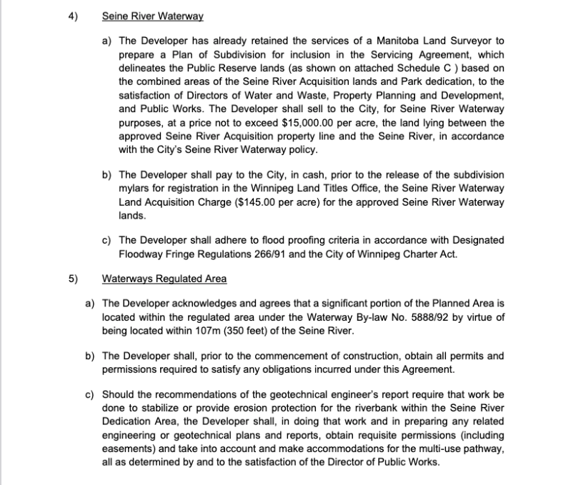
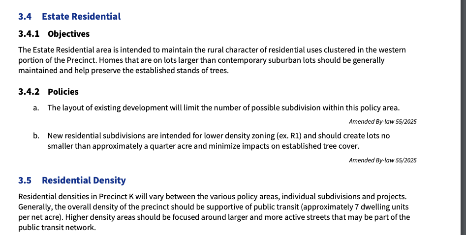
It is interesting to note the subject DASZ has shown changes in nearby planned lots immediately east of the coulee from future R1 Estate to R1 Large. The City mandates that new lots in the Creek Bend Estate area be approximately ¼ acre in size (about 10,890 sf). The prescribed size falls somewhere in between R1 Estate (minimum 20,000 sf) and R1 Large (minimum 5,500 sf). Industry professionals may already believe that R1 Large is the most applicable Highest and Best Use zoning designation for the Smith Farm homestead lands.

(Please feel free to comment on this analysis).